")
Most contractors know that it is important to call 811 to get a public utility mark-out. But that type of mark-out is limited to public utilities, in the public right of way. The majority of underground utilities and subsurface structures that pose a safety risk are privately owned and are not the responsibility of 811 to locate. Safe digging on private property requires private utility locating.
People often ask me if we can use our ground penetrating radar (GPR) systems to locate underground sewer lines, electric utilities, old tanks or other buried objects. My answer is GPR profiles are spectacular in identification of underground lithology and detection of hidden utilities, tanks, etc. – when utilized under the right conditions.
GPR is not perfect for every situation but there are other technologies we can use to augment the GPR survey that give us an even greater opportunity to locate and identify buried objects.
In this article I will explain the use and limitations of GPR, Radio Location and Electromagnetic Detection technologies to detect plastic pipes, metal conduit, buried tanks, former utility trenches, lithology and other objects hidden beneath the surface.
Ground Penetrating Radar
GPR is one of the most effective high-resolution geophysical techniques available for shallow engineering and environmental projects. GPR methods are both high-resolution and highly site specific, which means they can produce excellent results – but only in specific conditions.
How GPR Works
GPR equipment includes a specialized antenna to transmit high-frequency electromagnetic pulses (radar signals) into the ground. These signals propagate and are then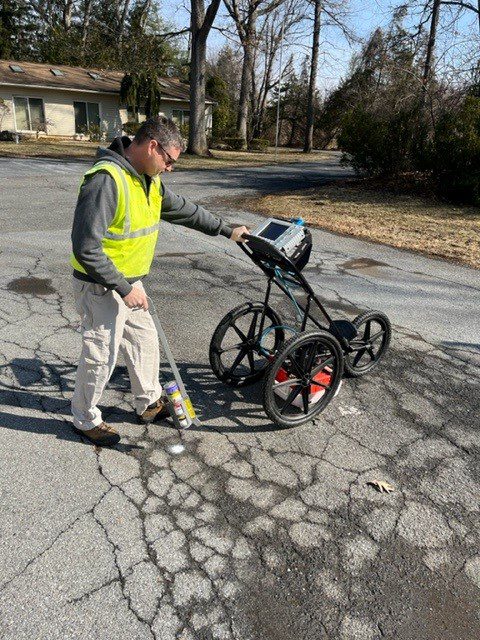 reflected by discontinuities or interfaces in soil materials and return to be detected by a receiver antenna. The reflected signals are processed and displayed on a graphic screen and recorder. The time axis is converted to depth by an estimated velocity algorithm and associated software. As the antenna is moved along the surface, the graphic display results in a cross-section record of distance traveled vs. depth of the reflected radar signatures.
Use and Limitations of GPR
GPR data is acquired in cross-sectional form (time vs. distance along the surface). If the survey happens to be parallel or at high angles to a buried structure, the equipment may produce confusing signals. We establish a grid and make a second pass at 90 degrees to the first pass to further identify buried structures.
The depth of penetration of the GPR signal is a function of soil conditions and the frequency of the radar antenna. In general, an antenna with a lower frequency will penetrate deeper than an antenna with a higher frequency. However, the resolution and the ability to image smaller, targets increase with increasing frequency. We typically utilize a 400 MHz antenna for targets located within 1ft – 20 ft of the surface and a 2,000 MHz antenna for targets located within 1in – 12in of the surface (i.e. rebar in cement.)
A GPR survey requires a relatively smooth surface (if the antenna bounces, the energy is not properly directed). GPR is most effective in low attenuation, non-conductive materials such as sandy soils or competent bedrock. It has limited effectiveness in high attenuation, conductive soils such as saturated clay.
Radio Location (Conductive and Inductive)
Radio Location has two modes of operation: CONDUCTIVE and INDUCTIVE.
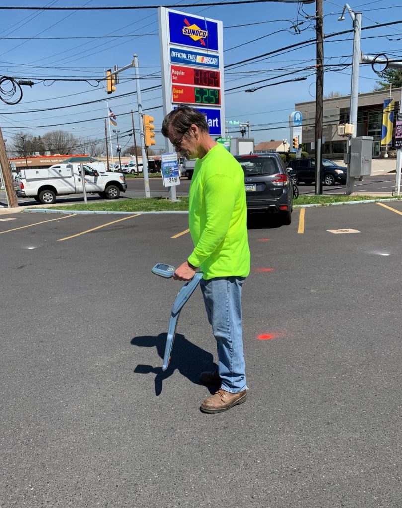 The CONDUCTIVE mode is utilized when a portion of a cable or pipe is exposed at the surface. A transmitter is attached directly to an exposed portion of the pipe or cable with a coupling clamp or ground rod assembly. The radio detection instrument detects the depth and direction of the utility.
The INDUCTIVE mode is utilized when there are no exposed portions of the underground utilities. A transmitter is used to induce an electromagnetic field into the ground. The transmitter radiates this field through both soil and water. In the inductive mode, the existence of metallic pipes are indicated but no depth information is provided.
Radio Detection Use and Limitations
Radio detection is highly effective in tracing metallic underground utilities. When the CONDUCTIVE mode is utilized, it is often possible to distinguish a single line among several crossing utilities.
Radio detection cannot be used to detect plastic lines or other underground features such as disturbed sediments. GPR is much better at locating those features. However, in places where entrances to plastic piping can be located, such as in a storm drain, the line can often be traced by inserting a metallic fish tape into the length of plastic pipe.
Unlike GPR, radio detection can be utilized in uneven terrain.
Electromagnetic Detection
Electromagnetic detection is utilized to detect buried metallic objects. Depth limitations are a function of the amount of metal in the object. A small near surface object will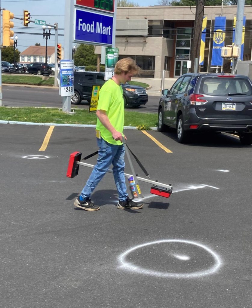 generate the same signal strength as a large, more deeply buried object.
Electromagnetic Detection Use and Limitations
Electromagnetic detection can only be utilized to detect metallic objects. Unlike Radio detection, electromagnetic detection does not provide depth information. It can be used in uneven terrain.
Key Takeaways
Ground Penetrating Radar, Radio Location and Metal Detection are all part of conducting non-destructive private utility mark-outs. These geophysical technologies can provide valuable subsurface information for decision making about construction, engineering or environmental projects. Be safe.


